Services
Smart mapping, smarter decisions.
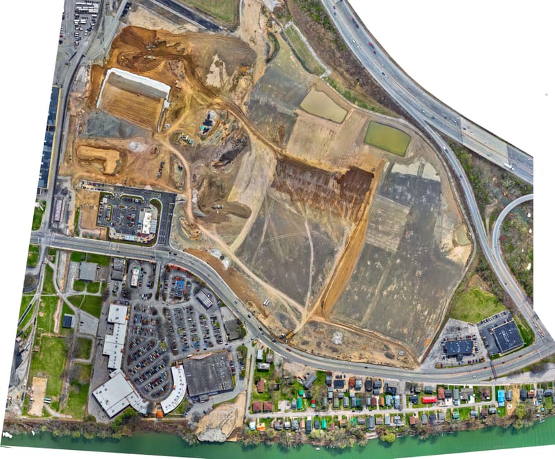
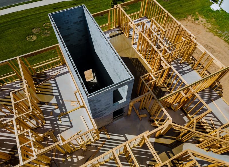
Construction Site Mapping
Construction site mapping with drones speeds up monitoring and documentation of construction sites. Orthophotos, point clouds, and elevation models provide a comprehensive, measurement-accurate picture of the site status.
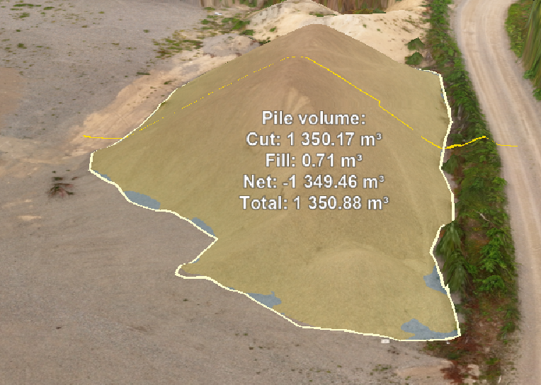
Volume Calculation
Centimeter-accurate volume and mass calculation with drones. Keep earth masses, stockpiles, and cut & fill volumes under control throughout the project with RTK accuracy.
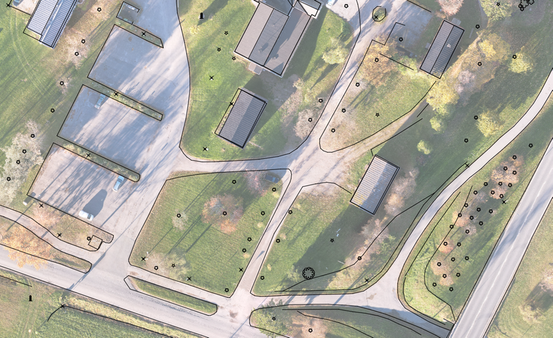
Orthophotos
High-resolution, georeferenced orthophotos and orthomosaics for industrial, construction, and real estate needs. Measurement-accurate visual data to support design and decision-making.
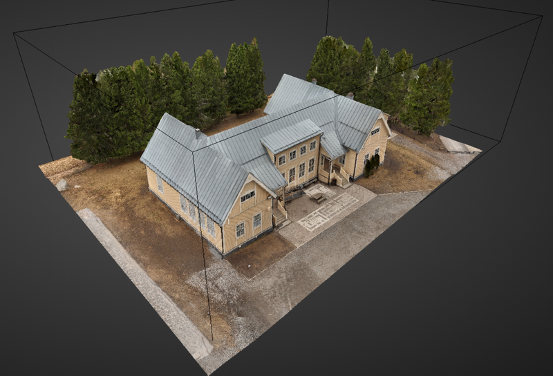
3D Models
Photogrammetric 3D models and 3D visualizations from drone surveys. Measurement-accurate, georeferenced models to support design, documentation, and communication.
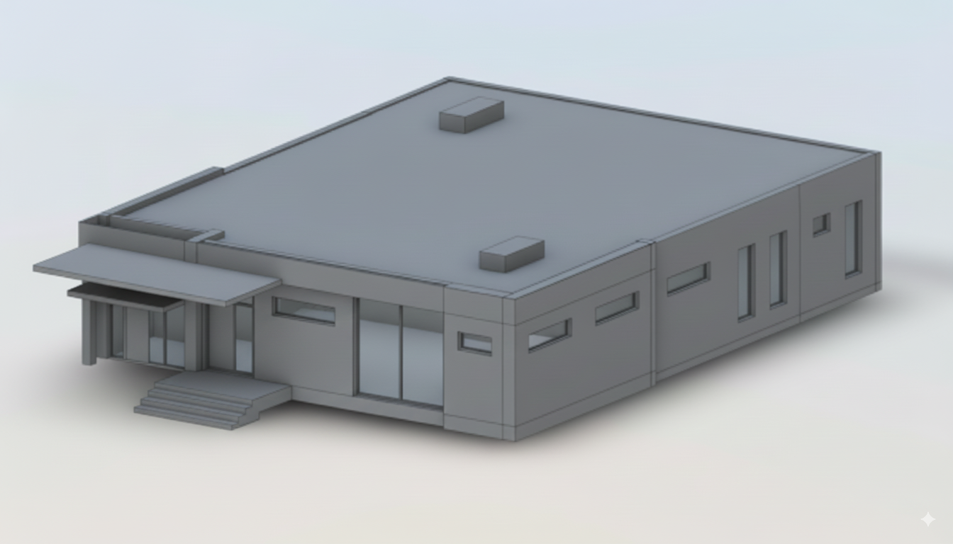
BIM Modeling
Information models (BIM) from 360° scanning of interior spaces. Precise Revit and IFC models and CAD drawings of existing spaces, ready for your design software.
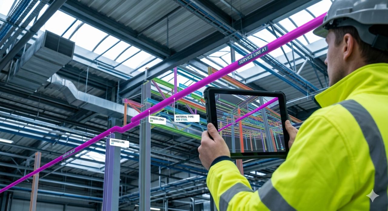
BIM Verification and Data Integration
Verification of the information model and integration of real-world data into your design systems. Make sure the as-built result matches the plan — and bring the drone data directly into the tools you use.
Inspection
Fast and efficient drone inspections of hard-to-reach and large-scale sites. AI-based defect detection.
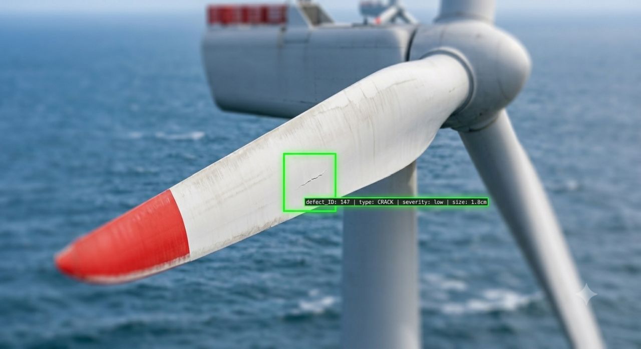
Wind Turbine Inspection
Drone-assisted wind turbine inspection with AI-based defect analysis. Find out the condition of blades and structures safely without climbing or rope access.
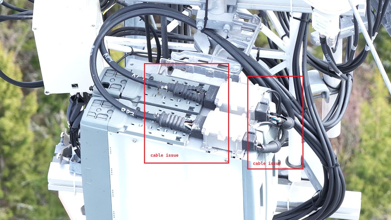
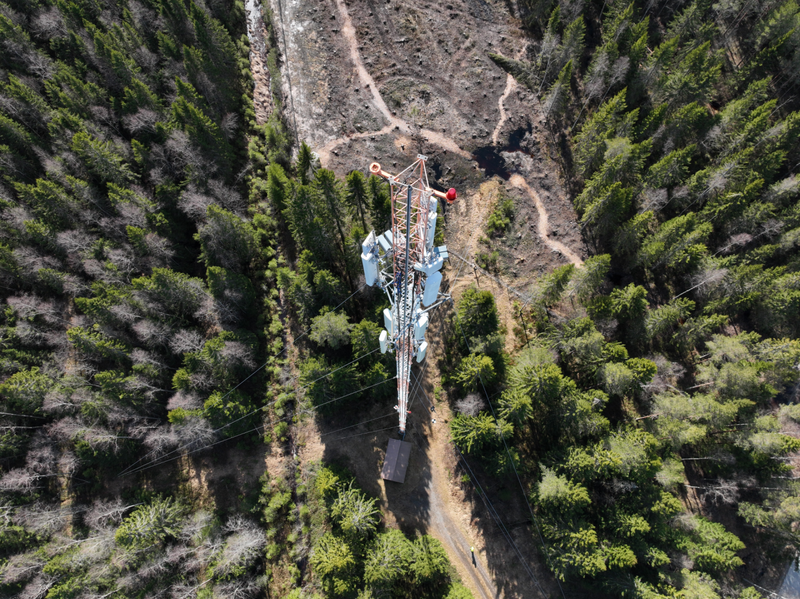
Mast and Tower Inspection
Drone-assisted mast and tower inspection with AI-based analysis. Find out the condition of antennas, mounts, and structures safely without climbing or operational downtime.
Aerial Photography
Professional aerial photos and videos for construction sites, properties, and marketing. Timelapse photography for documenting project progress.
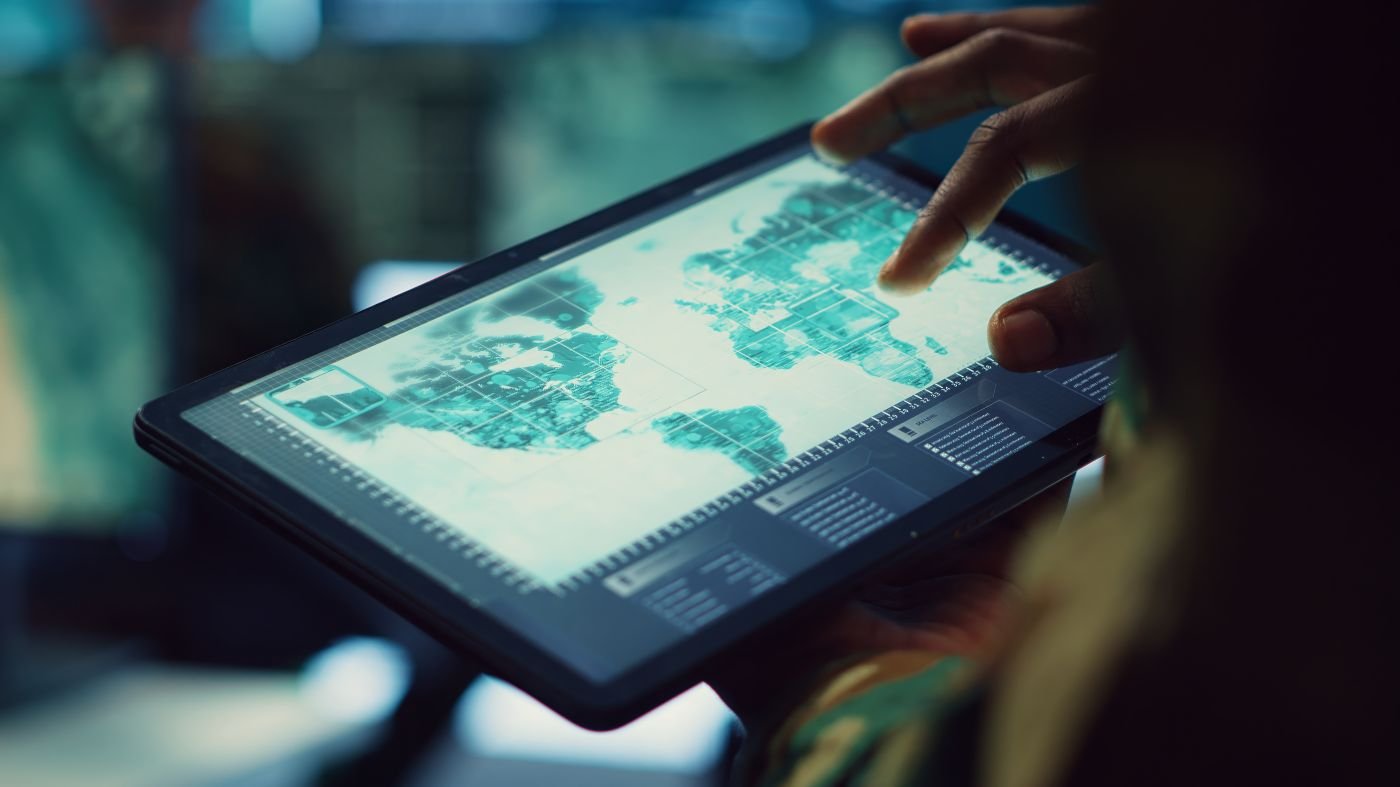
Geospatial Data
Geospatial analyses, GeoAI, and GIS/CAD conversions. Strong geospatial expertise combined with drone data — data that supports decision-making.
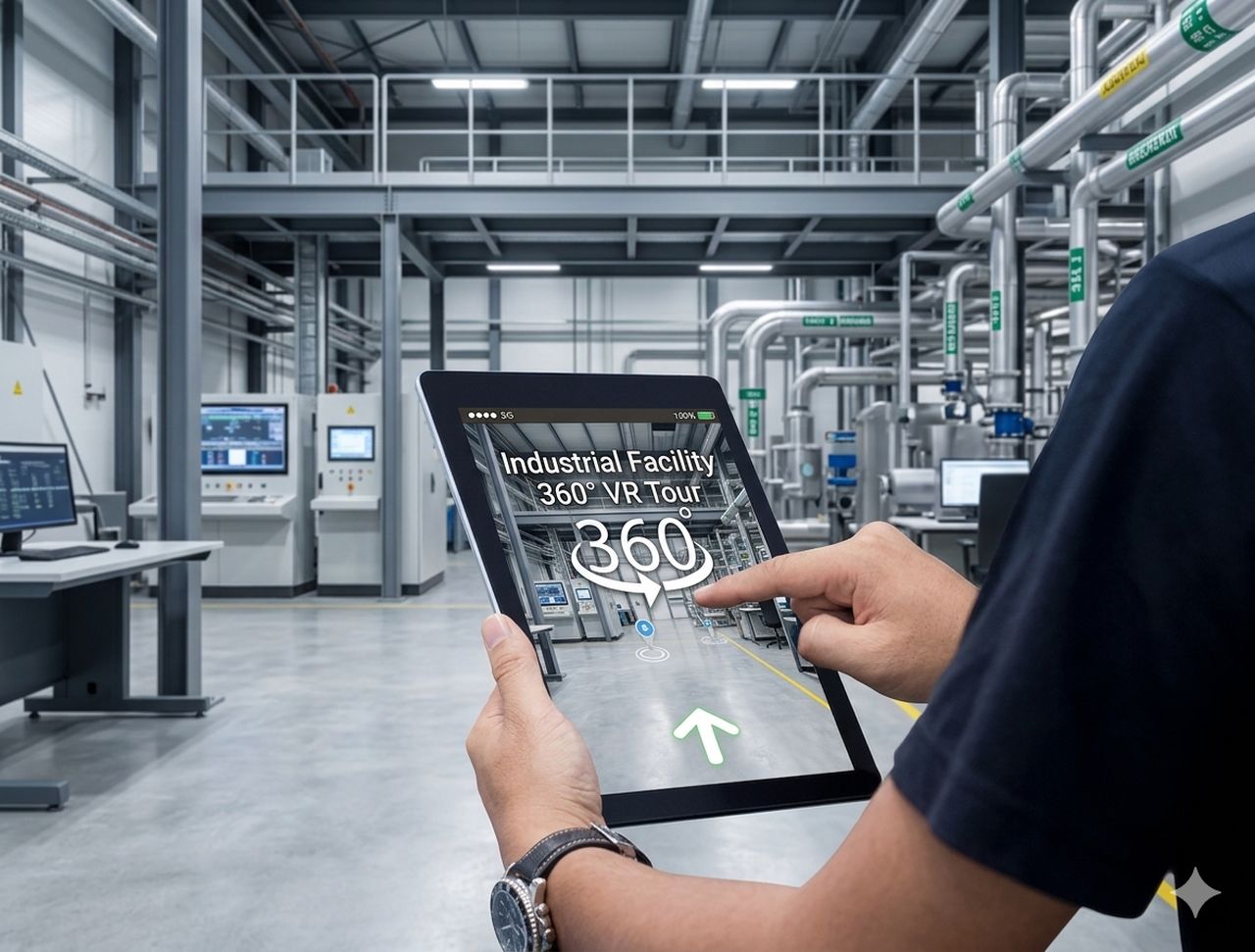
360° Scanning
Professional 360° scanning with integrated laser measurement. Interactive virtual tours, precise floor plans, and ±1 cm measurement accuracy.
Haluatko tietää lisää palveluistamme?
Ota yhteyttä →