ORTHOPHOTOS
Orthophotos — geometrically corrected aerial images for precise mapping
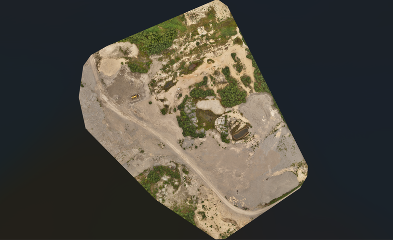
Orthophotos are geometrically corrected aerial images where distortions have been eliminated and which can be used directly as a measurement source. Our drone orthophotos integrate seamlessly with GIS systems, CAD software and land use planning tools.
What's included in our orthophoto service?
- High-resolution orthophotos — centimetre-level pixel size even for large areas
- Geometric correction — distortion-free, measurable aerial image
- Land use planning — documentation of the area's current state for zoning purposes
- Property development — mapping of plots, areas and surroundings
- GIS integration — direct use in geographic information systems
- Mapping — area maps and base drawings for construction planning
Where are orthophotos useful?
Orthophotos are an essential tool wherever precise location information from aerial images is needed. Land use planners, architects, developers and infrastructure authorities use them daily.
- Detailed plan and master plan work
- Property valuation and presentation
- Infrastructure planning and monitoring
- Environmental monitoring and documentation of changes
The delivery process
- Area delimitation and planning — we define the scope and resolution of the photography
- Drone photography — systematic photography flight with RTK positioning
- Orthorectification — geometric correction and optimisation of pixel size
- Delivery — finished orthophoto in GeoTIFF or other desired format
Request a quote for orthophoto service
Tell us about your area — we'll deliver a quote within 24 hours.