VOLUME CALCULATION
Volume calculations with drones — mass surveys with centimetre accuracy
Drone-based volume calculations produce accurate measurements of excavated materials, fill materials and stockpile volumes quickly and cost-effectively. With RTK accuracy, we achieve centimetre-level precision without extensive field surveys.
What's included in our volume calculation service?
- Excavated materials — precise volume calculation for excavations and cuts
- Fill materials — volume calculation for embankments and levelling
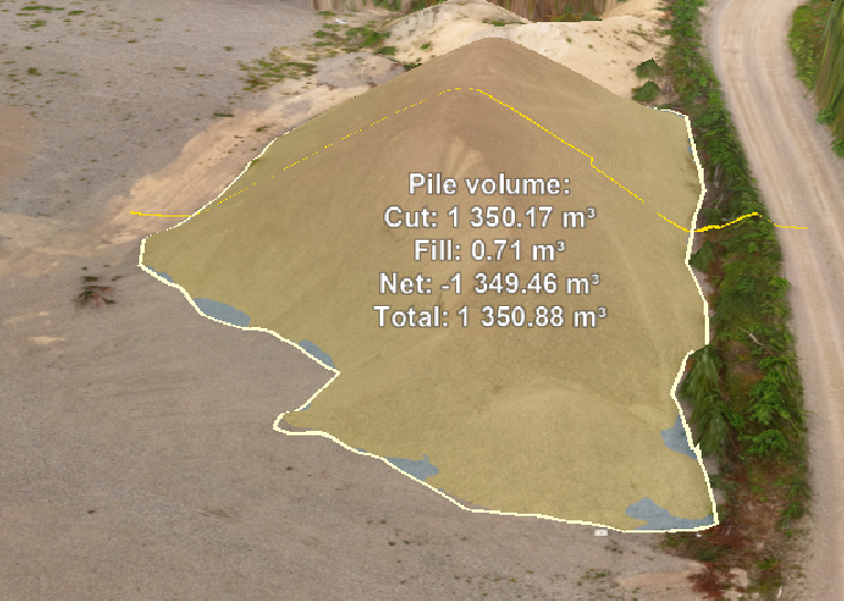
- Stockpile measurements — volume of soil material stockpiles, quarry or woodchips
- RTK accuracy — centimetre-level precision with GPS reference
- Quarries — blasting volume tracking and reporting
- Construction sites — continuous volume tracking during the project
Why choose drone-based volume calculations?
Traditional field surveying is slow, expensive and requires personnel on site. Drone-based volume calculations cover a large area in an hour — without stopping operations. Results are comparable to traditional methods and often more accurate over large areas.
- Fast results — entire area measured in a single flight
- Cost-effective compared to traditional field surveying
- Safe — no personnel in hazardous environments
- Repeatable — regular measurements for project monitoring
The delivery process
- Site assessment — we review measurement needs and site characteristics
- Drone flight — survey flight with RTK accuracy
- Volume calculation — volume calculations from 3D model or point cloud
- Report — clear mass management table and visualisations
Request a quote for volume calculations
Tell us about your site — we'll deliver a quote within 24 hours.